Yampa
The last undammed major tributary in the Colorado River system. Runs only on spring snowmelt - the window is weeks, not months.
The run
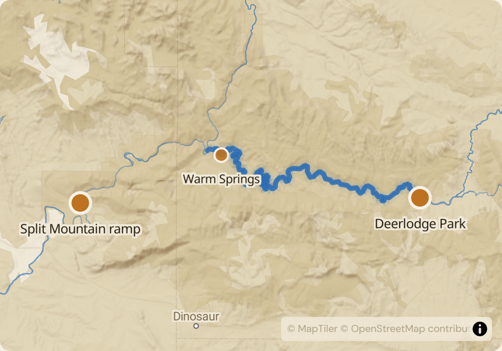
71 miles over 4-5 days through Dinosaur National Monument. The first 46 miles are the Yampa itself - canyon walls up to 1,500 feet, a dozen Class II-III rapids, and one Class IV at Warm Springs Rapid. At Echo Park the Yampa joins the Green River, and the remaining 25 miles drop through Whirlpool Canyon and Split Mountain Canyon to the take-out. The Yampa is the last undammed major tributary in the Colorado River system, which means the flow tracks snowmelt directly: big in May, gone by July.
The permit
Shares permit #250014 with Lodore, lottery runs December 1 through January 31 for launches between May 1 and June 30. Odds are low - roughly 5-10% for core weeks. The permit season is short and the river has capacity for only ~50 launches per year. NPS also maintains a cancellation list at the Dinosaur Visitor Center; monitoring recreation.gov picks up most cancellations faster than the list does.
Timing
Peak flow is mid-May through mid-June. In a normal year the Yampa runs 8,000-15,000 CFS; in a heavy snow year it can spike to 25,000 CFS. Warm Springs Rapid is consequential at high water - the hole at the bottom pushes boats backward. By late June flows drop fast and the upper river becomes technical and rocky. By mid-July the Yampa is typically too low to float without dragging and most NPS permits expire before that point. If you draw a permit, launch on the earliest date in your permit window that water allows.
Logistics
Put-in is Deerlodge Park, 53 miles of gravel off US-40 between Maybell and Massadona, CO. Take-out is Split Mountain in Dinosaur National Monument. Shuttle is 150 miles around the monument - most parties hire a shuttle ($400-600) or stage two vehicles. Vernal, UT is the closest full town. Maybell has gas and little else.
Monitor Yampa for cancellations
We poll recreation.gov every minute and email you the moment a permit opens up. No app, no hype, just the alert.
Start monitoring