San Juan River
Desert river through Navajo country - goosenecks, cliff dwellings, and petroglyphs, with good permit odds and year-round access.
The run
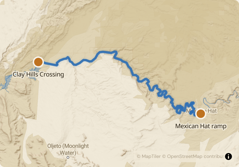
Two standard sections. Upper: 26 miles from Sand Island to Mexican Hat, Class I-II, mostly flatwater through Comb Ridge and past Navajo Twin Rocks, with side hikes to River House ruin and petroglyph panels along the canyon walls. Lower: 57 miles from Mexican Hat to Clay Hills Crossing, Class II-III with Government Rapid (Class III, mile 15) and Ross Rapid (Class II-III, mile 26) being the named features. The Goosenecks - the 5-mile meander where the river folds back on itself - are in the lower section. Most parties do one or the other; full 83-mile runs combine both.
The permit
Lottery runs December for launches between April 15 and July 31. Odds are good - roughly 25-50% for most dates. Fall and winter permits are first-come-first-served and rarely full. The San Juan flows through Navajo and Ute Mountain Ute reservation land; the BLM permit covers put-in and take-out access.
Timing
The San Juan is a runoff river: peak flows in April-May can exceed 5,000 CFS, then drops through summer to 800-1,500 CFS by August. Low water (below 800) slows the trip and bones out the bigger rapids; above 3,000 the river moves fast and the goosenecks eddy out less. July through September is the most popular season: warm days, predictable flows, few bugs. April and early May have the biggest water and are cold at night.
Logistics
Sand Island put-in: Bluff, UT. Mexican Hat put-in or take-out: Mexican Hat, UT. Clay Hills Crossing take-out: 50 miles of dirt road off UT-261 - passable to 2WD in dry weather, impossible after rain. Shuttle companies run out of Bluff and Mexican Hat, $200-400 one-way. Clay Hills has no services; the closest gas and water are in Mexican Hat or Bluff.
Monitor San Juan River for cancellations
We poll recreation.gov every minute and email you the moment a permit opens up. No app, no hype, just the alert.
Start monitoring