Middle Fork of the Salmon
A hundred miles of wilderness, hot springs, cold water, and no roads in or out once you launch.
The run
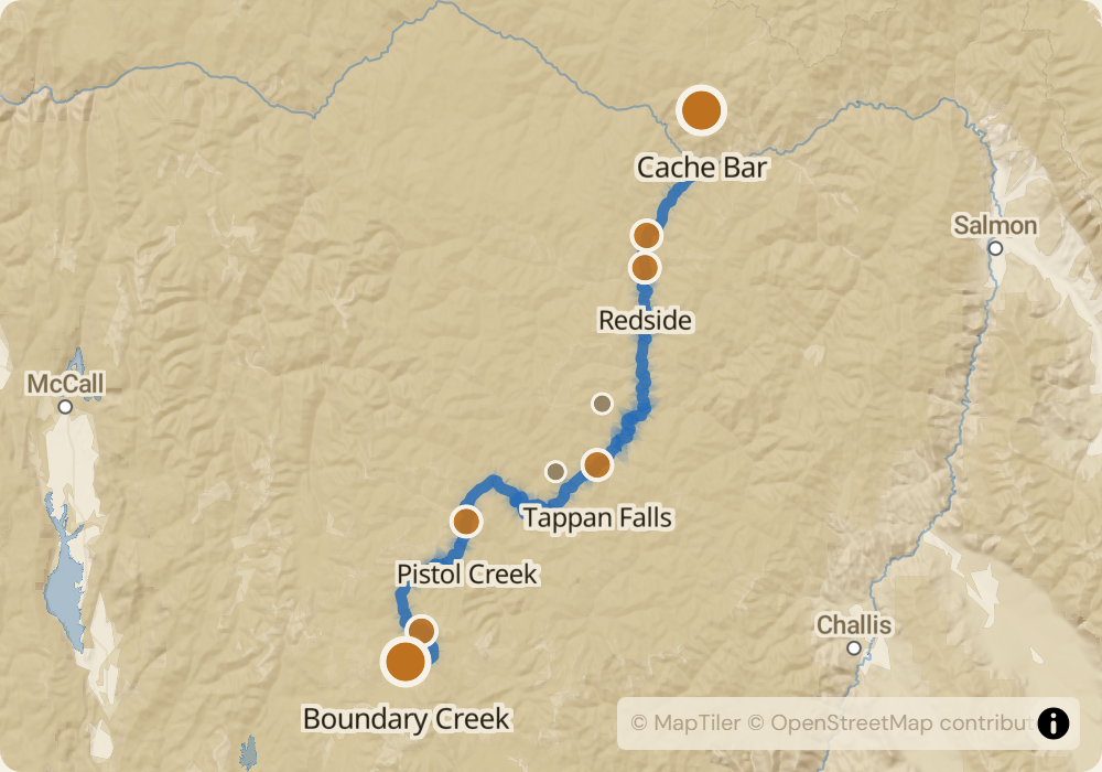
The Middle Fork drops 3,000 feet over 100 miles through the Frank Church-River of No Return Wilderness - the largest contiguous wilderness in the lower 48. There are no roads, no cell service, and no easy way out once you launch. The run starts at Boundary Creek at 5,700 feet elevation, immediately enters continuous Class III whitewater for the first 25 miles, then drops into deeper canyon with bigger, more spaced-out Class IV rapids on the lower half. The character changes as the water volume grows: the upper river feeds off snowmelt and stays cold and technical; by the Impassable Canyon near river mile 85 you're running 2,500+ CFS through basalt cliffs that close in on both sides.
The permit
Lottery runs December through January for launches between May 28 and September 3. Permits for the core high-season weeks (mid-June through late July) see odds around 2-3%. Shoulder dates are easier. A ranger issues your permit in person at Boundary Creek on launch day, checks your gear, and briefs you on conditions. Cancellations happen, but not often - the core group-of-six permits holders typically plan their trip a year ahead and follow through. A cancellation monitor matters most for parties willing to go on short notice (days, not weeks).
Timing
Peak flow is late May through mid-June when the Salmon-Challis snowpack melts out. Flows above 5,000 CFS wash out many rapids into big wave trains and push parties downstream fast - better for experienced boaters. Mid-July through early August is the classic window: warm weather, 3,000-4,000 CFS, readable water, hot springs usable, every rapid with a clean line. Late August into September drops to 1,500-2,500 CFS; the rapids get technical and bony, parties move slower, but camps are dry and mosquitoes are gone. If you can launch mid-July, do that.
Logistics
Put-in is Boundary Creek off FSR 568, about 22 miles of rough gravel road off Highway 21 north of Stanley, Idaho. Most parties hire a shuttle given the distance and roughness of the road; $400-700 depending on number of vehicles and operator. Take-out is Cache Bar at the confluence with the Main Salmon. From Cache Bar you're shuttled out either by road (another long gravel drive) or by bush plane to Salmon, Idaho. Stanley is the closest town for pre-launch supplies - population 100, last gas, last cell signal, last grocery.
Monitor Middle Fork of the Salmon for cancellations
We poll recreation.gov every minute and email you the moment a permit opens up. No app, no hype, just the alert.
Start monitoring